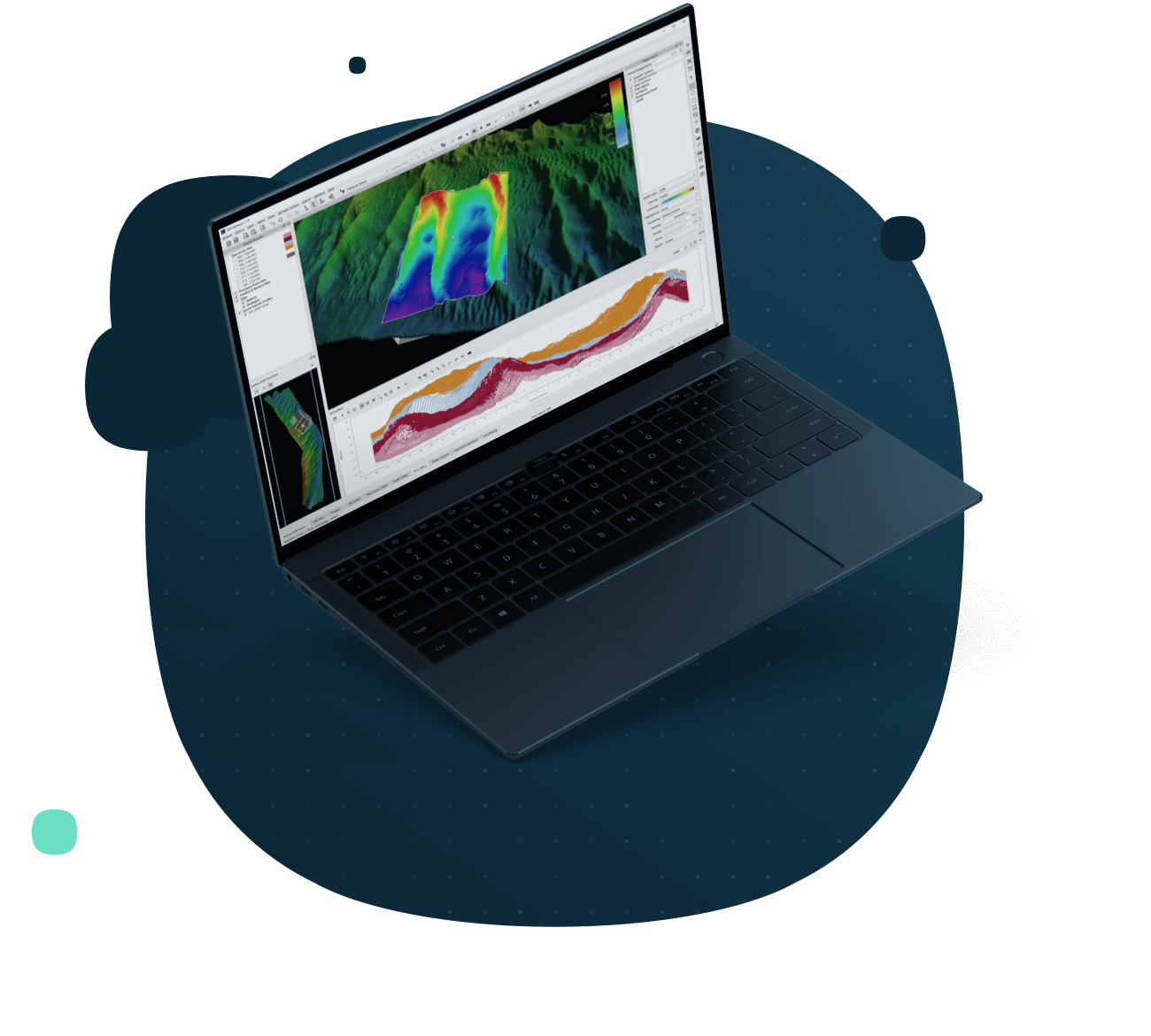
The best tools, faster and easier.
Qimera presents the utmost in speed, ease of use, and capabilities.
A Paradigm Shift in Hydrographic Data Processing

The mission of Qimera is to make hydrographic data processing as intuitive and as simple as possible, while still offering powerful capabilities to those that need them, without cluttering the workflow for those that don’t.
Reasons to start with Qimera. Beyond the basics.
Qimera ensures absolute ease of use, allowing for inexperienced personnel to easily be using Qimera while the automated and streamlined workflow effectively circumvents human error that might result otherwise. Yet still the software contains the most advanced and cutting-edge tools to ensure the highest quality products, delivered in the most timely fashion.
Trusted worldwide. By the biggest and the best.
Whether we are using it to deliver vast multi-disciplinary surveys for LINZ (New Zealand Hydrographic Authority) or combining LiDAR and MBES for engineering surveys, QIMERA helps us understand the value of what’s submerged.
We’re here to help. License benefits.
Coverage options
We’re flexible. Licenses available by subscription, as perpetual, or on a rental basis.
What’s best for you? Softlock and dongle options are available.
We’re ready to assist. Licenses include online and phone support services.
Never get behind. Licenses include access to our latest updates and features.
We innovate. Licenses keeps you on the cutting edge of the industry.
Let’s get specific.
Qimera specifications

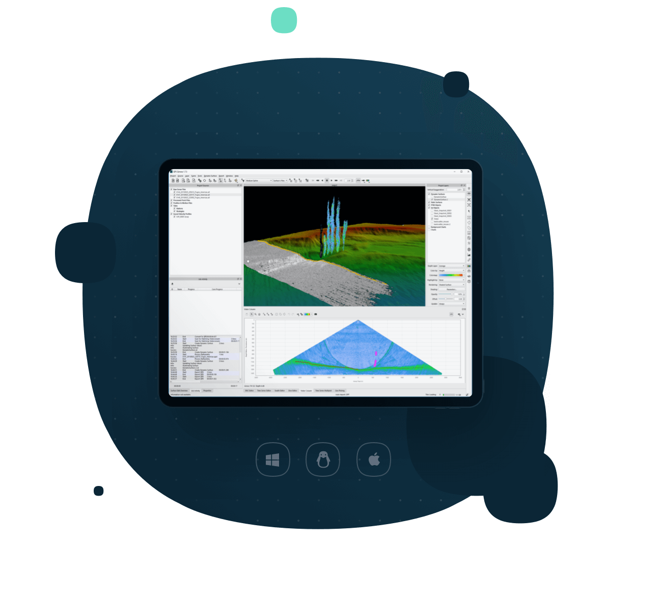
Everything you need to know about Qimera is below, with regards to specifications, supported platforms, system requirements, and supported file formats (data shown to the left courtesy of Fugro).
Measured & Proven
Full sonar processing
Covers all major manufacturers for any survey platform, including surface vessels, ROV, AUV, and ASV.
Point cloud processing
Includes editing, filtering, and cleaning for a wide variety of point cloud formats.
Automated data import
Rich data extraction allows for a “hands-off” data import and automatically generated vessel files.
Guided workflows
Automated suggestions of the next logical user action, to guide personnel and eliminate human error.
Processing state management
Intelligent processing management to ensure the correct sequence of post-processing actions with a single click.
Qimera Live
“Hands-off” near-real time data processing and gridding.
Qimera Midwater
Add-on for fast, accurate water-column processing for QINSy DB, Kongsberg ALL and KMALL, and Reson/Norbit S7K formats.
Backscatter processing
Add-on for seabed backscatter processing and mosaicking via Fledermaus Geocoder Toolbox.
Qimera specifications
collected on one page:
Qimera is a multibeam data processing and analysis software. From its inception, the mission of Qimera is to make hydrographic data processing as intuitive and as simple as possible, while still offering powerful capabilities to those that need them, without cluttering the workflow for those that don’t.
Measured & Proven
Full sonar processing
Covers all major manufacturers for any survey platform, including surface vessels, ROV, AUV, and ASV.
Point cloud processing
Includes editing, filtering, and cleaning for a wide variety of point cloud formats.
Automated data import
Rich data extraction allows for a “hands-off” data import and automatically generated vessel files.
Guided workflows
Automated suggestions of the next logical user action, to guide personnel and eliminate human error.
Processing state management
Intelligent processing management to ensure the correct sequence of post-processing actions with a single click.
Qimera Live
“Hands-off” near-real time data processing and gridding.
Qimera Midwater
Add-on for fast, accurate water-column processing for QINSy DB, Kongsberg ALL and KMALL, and Reson/Norbit S7K formats.
Backscatter processing
Add-on for seabed backscatter processing and mosaicking via Fledermaus Geocoder Toolbox.
Multibeam calibration
Easy to use Patch Test tool with auto-solve functions for quick use.
Time series editors and multiplots
Easily view and correlate motion data streams with bathymetry for fast and intuitive troubleshooting.
Cross check tool
Performs a statistical analysis of cross line beam footprint values versus a main scheme surface, with plot exports for reporting.
Automated data cleaning
Customizable and easy to use filters include the Spline filter, CUBE filter, and Blocking filters.
Multi-processor workflows
Cooperative Cleaning and Production Line Processing workflows allow for multiple processors for work on the same project simultaneously.
Product generation
Visualization, gridding, and data exporting in various formats.
“Connected” S-57 feature management
Add-on allows for S-57 feature creation and editing while maintaining linkages to bathymetry to ensure final charting products are synced.
Wobble tool
Quickly identify and resolve any errors made in the multibeam and motion sensor integration.
TU Delft sound speed inversion
Sound speed refraction algorithm is automated, repeatable, and generates output for vetting and reporting.
Extinction tests
Finds the outer extents that a multibeam system can achieve, helpful as an assessment of long-term acoustic health.
Supported platforms
Windows
Windows 10 and 11* (64-bit)
*Excluding N and KN versions
Mac OS X
10.15.x
Linux
RedHat Enterprise Linux 7 (64 bit)
RedHat Enterprise Linux 8 – Requires X.org, currently does not work with Wayland (app will fail to start with an error about wayland).
Ubuntu 18.04 LTS
Ubuntu 20.04 LTS
Ubuntu 22.04 as of 22.04.1 – Requires X.org, currently does not work with Wayland (app will fail to start with an error about wayland).
System requirements
Processor
Intel i3 2.4+Ghz / AMD equivalent (minimum), Intel i5 or i7 2.6+Ghz / AMD equivalent (recommended)
Video card
Minimum: NVIDIA 100 series or better (GeForce 100M for mobile), AMD HD4xxxx, Intel HD2000, Support for Open GL 3.0+
Recommended: NVIDIA GeForce 700, 900, or 10xx series (GeForce 600M or better for mobile), AMD R5/R7/RX or better, Support for OpenGL 4.1+
Storage device
Recommended: Solid State Drive (SSD)
Memory
8 GB (minimum), 16 GB+ (recommended)
Monitor
Resolution of 1280×1024 (minimum), 1600×1200 or better (recommended)
Mouse
2 button with scroll wheel, 3 button mouse, or trackpad equivalency
Supported file formats
Sonar source data import formats
DB
ALL (mb56)
S7K
HSX
JSF
GSF
XSE
R2SC
KMALL
Processed point formats
9-Column ASCII Lidar
ASCII XYZ
Atlas SURF
Atlas SURF v4
CnC Binary
CnC Trace
Danish Geographic FAU
Danish FAU/FAU2
Geoswath Kongsberg
Hydro 93 Binary
Hypack Hysweep
IVS Binary
LADS Mark II
LAS
LASzip
MBSystem Fast Bathymetry File
MPA/CARIS ASCII
MapInfo MIF
NAVO GSF
NAVO/CARIS ASCII
Neptune PROC
OMG Merge
PFM
PDS2000
QPS QPD Versions 1 & 2
RAN HTF
SHOALS 1K
SHOALS Hydro/Topo Airborne
SHOALS OUT
SHOALS TOF
SHOM Pivot
Swedish Binary DIS
XSE Data Exchange
CARIS Processed Depths *License dependencies apply
Position and motion formats
Applanix POSMV raw logging (.000)
Applanix SBET
Applanix SMRMSG
Kongsberg BIN
NovAtel SBTC, SBIC
Kongsberg Seatex SRH
Other source data formats
ASCII Navigation
ASCII Tides
ASCII SVP
Caris SVP
Hypack SVP
QINSy SVP Database
Reson SVP
Kongsberg ASVP
Tide data formats
QINSy Tide Data
QINSy Regular Tide File
BODC Tide format
NOAA CO-OPs (OPeNDAP and TideBot)
Caris Tides
Swedish Maritime Authority
ARGOSS – Fixed Format
COWLIS – Canadian Hydrographic Service
MSQ Dialmace Format
PREDUCT – Dutch Navy
RIKZ – Dutch Public Works
SHOM
Qinsy Tide Definition QTF
Zoned tides ZDF
Grid formats
ArcView Binary Grid
ArcView Ascii Grid
Ascii Gridded Data
Ascii Surfer Grid
BAG/Open Navigation Surface
BIL DEM
ER Mapper Grid .ers
Final Survey Grid .fin
Fledermaus Version 6 DTM
Floating Point GeoTIFF Grid
Fugro GRI
GMT Grd
Grass GIS DTM
GUTM Grid
ISIS grd
OMG R4/mos
QPS Grid
Raw Binary Grid
USGS DEM
Image formats
.tif
.tiff
.jpg
Point file formats
9-Column ASCII Lidar
ASCII XYZ
Atlas SURF
Atlas SURF v4
CnC Binary
CnC Trace
Danish Geographic FAU
Danish FAU/FAU2
Hydro 93 Binary
Hypack Hysweep
IVS Binary
LADS Mark II
LAS
LASzip
MBSystem Fast Bathymetry File
MPA/CARIS ASCII
MapInfo MIF
NAVO GSF
NAVO/CARIS ASCII
Neptune PROC
OMG Merge
PDS2000
PFM
QPS QPD Versions 1 & 2
RAN HTF
SHOALS 1K
SHOALS Hydro/Topo Airborne
SHOALS OUT
SHOALS TOF
SHOM Pivot
Swedish Binary DIS
XSE Data Exchange
Line file formats
CAD
ArcGIS Shapefiles
ASCII lines
Highlights
Added Autozoom capability to the Patch Test Tool and Wobble Analysis Tool to better handle plot updates.
GSF import will now try and auto-detect the source datum if it was populated in the .gsf. Only geographic coordinate systems will be available for selection when importing to avoid confusion.
Added auto reporting to the Line Height Matching Tool.
The filter preview in the slice editor will allow you to continue to use Qimera if an expensive filter is being previewed.
Editing the cable/pipe TOP detection will now regenerate the X-Point listings (if available) position for that detection.
Bugs
Processing / Source Files
Fixed the Filter Profile selection when running a filter on selected files.
Fixed the Systems to Filter option when running a filter on selected files.
Added back the warning in the Activity Log when creating an empty grid.
Fixed a loop of warning messages displayed when using the time series editor and autoprocessing was selected.
Fixed a string comparison error that caused GGK position strings to not be read from .kmall files.
Fixed an issue with recompute colormap range not working for processed point files.
Fixed an issue reading the sensor depth from .kmall files.
Fixed a crash when importing a .jsf file with no sound speed recorded in the file.
Added a warning message when files fail to process, potentially due to being open elsewhere.
Fixed a crash when adjusting the colormap range of .sd point files.
Fixed a crash when reading .kmall watercolum packets with a large number of samples.
Fixed a crash when importing a .kmall file where one head of a dual head system was turned off.
Fixed an issue when extracting a CUBE hypothesis strength layer when the values are 0.
Fixed an issue creating TVU layers when the soundings are in the colormap underflow or overflow color.
Fixed an offset issue when viewing water column from a Reson T-series dual head multibeam.
Fixed an off by one beam numbering issue when filtering or blocking.
Tools and Editors
Fixed the filter preview in the cable/pipe TOP detection tool when the filter profile was changed.
Fixed the Systems to Filter option when running a filter in the cable/pipe TOP detection tool.
Fixed an issue with the slice editor toolbar buttons being disabled when using the polygon selection.
The ctrl key will now invert the accept/reject selection in the Swath Editor.
Fixed an issue when saving snapshots in the Slice Editor.
Improved the speed of the cable/pipe TOP detection tool.
Fixed the sounding selection in the water column viewer when using a stacked buffer.
Fixed an issue with the patch test tool not removing temporary files when it was run from Qinsy.
Disabled the geopicking dock when using the patch test tool.
Fixed an issue where the first ping was not being displayed in the Water Column viewer.
Fixed an issue where sounding flags were not being preserved in the slice editor after moving the selection off and back onto the dynamic grid.
Importing / Exporting
FAU export will now have include rejected soundings on by default, to ensure beam number alignment if re-importing cleaned .fau files.
Fixed a crash when exporting to CAD objects.
Fixed a column alignment issue when exporting a cable/pipe to ASCII with X-Point Listings created.
Fixed an issue importing SVPs with negative sound speeds.
Fixed an issue with the layer extents from a multi-layer static grid.
Fixed a crash when exporting to GSF from a raw sonar file with a corrupt packet.
Fixed an issue when converting feet to meters when importing binary navigation.
Fixed a crash when the metadata for a tide file is corrupt or missing.
Disabled the Include raw backscatter imagery checkbox when exporting to GSF if the raw bathymetry and snippets are not present.
Exporting to a Static Grid Layer and overwriting a layer will preserve the layer order.
Fixed an issue when exporting files to GSF with extended ASCII characters.
Added a better warning when the path length or filename is too long for Windows to handle.
Other
Fixed an issue with the Dynamic Lighting (old Fledermaus 7 shading).
Contact email for obtaining software installation package: gosoftvip@163.com The resources are sourced from the internet, and this introduction is for learning purposes. If there is any infringement, please contact us for deletion!
For more info write me
Email : gosoftvip@163.com
telegram : @sacyou888
